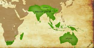
The boundaries of India have evolved significantly over thousands of years, shaped by geological changes, migrations, invasions, and political developments. Here’s an overview of India’s geographical and political boundaries from 10,000 BC to the present day:
Prehistoric India (10,000 BC – 3000 BC)
- Geographical Features: During this period, India was part of the Indian subcontinent, which was still connected to Africa and Madagascar as part of the ancient supercontinent Gondwana.
- Human Settlements: Early humans migrated to the Indian subcontinent around 70,000–50,000 years ago. By 10,000 BC, hunter-gatherer communities were established across the region.
- Boundaries: The subcontinent was defined by natural boundaries:
- North: The Himalayas.
- South: The Indian Ocean.
- East: Dense forests and the Brahmaputra River.
- West: The Indus River and the Thar Desert.
Indus Valley Civilization (3300 BC – 1300 BC)
- Geographical Extent: The Indus Valley Civilization (Harappan Civilization) was one of the world’s earliest urban cultures, spanning present-day:
- Northwest India: Punjab, Haryana, Rajasthan.
- Pakistan: Sindh, Punjab, Balochistan.
- Afghanistan: Parts of the eastern region.
- Major Cities: Harappa, Mohenjo-Daro, Dholavira, and Lothal.
- Boundaries: The civilization extended from the Himalayas in the north to the Arabian Sea in the south, and from the Indus River in the west to the Yamuna River in the east.
Vedic Period (1500 BC – 500 BC)
- Aryans and Early Kingdoms: The Indo-Aryans migrated into the Indian subcontinent, settling in the Sapta Sindhu (Land of Seven Rivers) region, including the Indus and Ganges river systems.
- Boundaries:
- North: Himalayas.
- South: Vindhya Mountains.
- East: Bengal.
- West: Indus River.
Mahajanapadas and Mauryan Empire (600 BC – 200 BC)
- Mahajanapadas: By 600 BC, 16 major kingdoms (Mahajanapadas) emerged, covering much of northern India.
- Mauryan Empire (322 BC – 185 BC):
- Founded by Chandragupta Maurya, the empire extended across most of the Indian subcontinent.
- Boundaries:
- North: Himalayas.
- South: Deccan Plateau.
- East: Bengal and Assam.
- West: Afghanistan and Balochistan.
Gupta Empire (320 AD – 550 AD)
- Golden Age of India: The Gupta Empire is considered a period of cultural and scientific flourishing.
- Boundaries:
- North: Himalayas.
- South: Narmada River.
- East: Bengal.
- West: Indus River.
Medieval India (600 AD – 1700 AD)
- Harsha’s Empire (606–647 AD):
- Covered northern India, from Punjab to Bengal.
- Chola Dynasty (9th–13th century):
- Dominated southern India, Sri Lanka, and parts of Southeast Asia.
- Delhi Sultanate (1206–1526):
- Ruled much of northern India, extending to the Deccan Plateau.
- Mughal Empire (1526–1857):
- At its peak under Akbar, the empire covered almost the entire subcontinent, except the southern tip.
Colonial India (1757–1947)
- British East India Company: Gradually took control of India, establishing the British Raj by 1858.
- Boundaries:
- North: Himalayas (including present-day Pakistan and Bangladesh).
- South: Indian Ocean.
- East: Burma (now Myanmar).
- West: Afghanistan.
Post-Independence India (1947–Present)
- Partition of India (1947): India was divided into two nations: India and Pakistan (East and West).
- Boundaries:
- North: Himalayas (including Jammu and Kashmir).
- South: Indian Ocean.
- East: Bangladesh (formerly East Pakistan).
- West: Pakistan.
Modern India
- States and Union Territories: India is divided into 28 states and 8 union territories.
- Boundaries:
- North: China, Nepal, and Bhutan.
- South: Indian Ocean.
- East: Bangladesh and Myanmar.
- West: Pakistan and the Arabian Sea.
